


MEDIEVAL LANDS
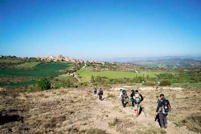
You are at the oldest historical point of Aragon. This is where the great history of the Crown of Aragon, the conquest of the Mediterranean, the Almogavars (lightly clad, quick-moving frontiersmen and foot-soldiers) and their warcry “Despierta Ferro!” (Awaken, steel!) all began. You are at the beginning of everything. Enjoy it. Savour it. It is an impressive place with the Pyrenees as a backdrop.
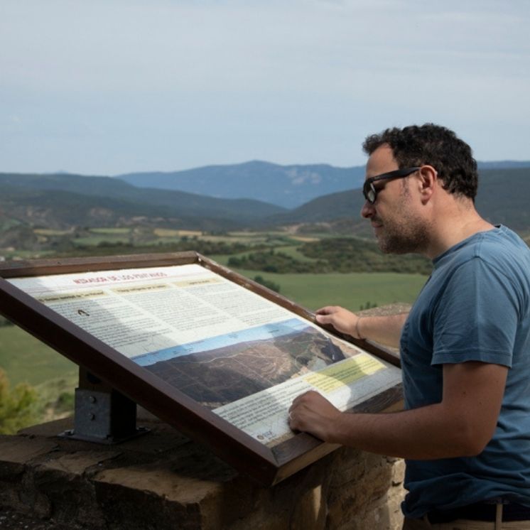
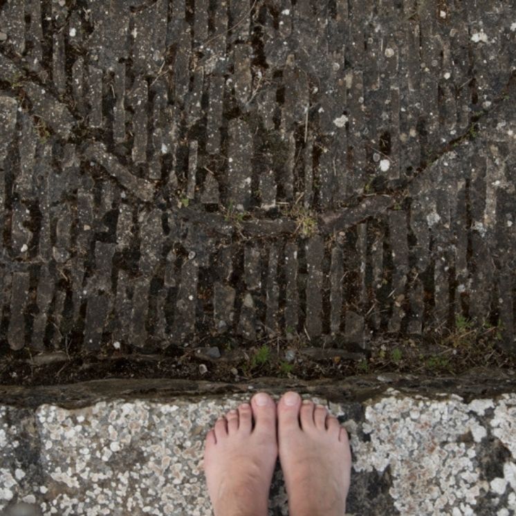
At each of the stops on this page, there is treasure to be found. To locate it, we provide you with coordinates and a series of helpful hints. We recommend that you download the free application available from https://www.geocaching.com/play where you find all our geo-located treasures and hints.
THE CREATION OF THE KINGDOM OF ARAGON
Aragón as a kingdom arose with the death of the Navarrese monarch, Sancho Garcés III The Elder. The territories under his command were divided between his four children: Ramiro I, inherited what was then the county of Aragon; García, his legitimate firstborn, reigned in his native Navarra; Fernando was given the county of Castile, and finally, Gonzalo was given Sobrarbe and the Ribagorza, two small Pyrenean counties.
In spite of not being anointed as such, all the documents of the time treat Ramiro I as a king, since he held the potestas regia in the territories under his control.
The four brothers focused on securing the territories they had inherited, which generated disputes among them. Ramiro strengthened the northern border by marrying Gisberga Ermesinda, daughter of Bernardo Roger, Count of Bigorre, in the year 1036. Later, in 1044, his brother Gonzalo died, and Ramiro annexed the territories that he had inherited, the Sobrarbe and the Ribagorza.
To the west, and around the main territories of our route, Ramiro and García Sánchez, at that time monarch of Navarre, disputed the border between their kingdoms. One of these confrontations ended with the hurried escape of King Ramiro.
In the year 1037 Ramiro used a past conflict in which he had provided soldiers to his brother, as an excuse to reclaim territories. Ramiro set out to take Tafalla, hastily and without his best men, but he was attacked at night by the Navarre forces and had to abandon his project and return to his domain. The king passed through towns like Sos, Navardún and Los Pintanos in his flight.MAP OF THE ROUTES
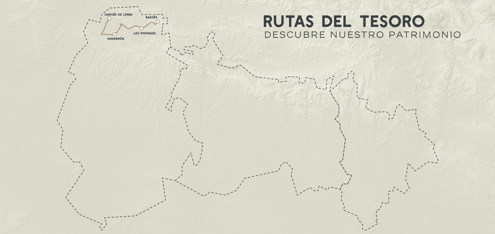
DOWNLOADABLE MAP AND ROUTES
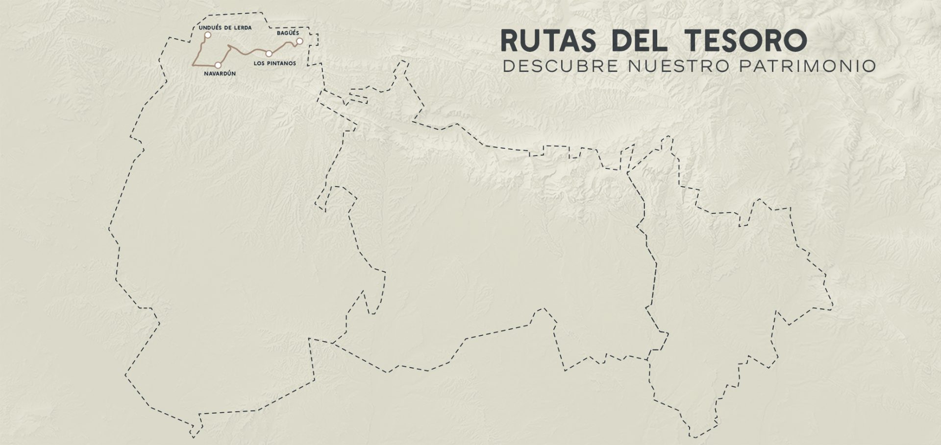
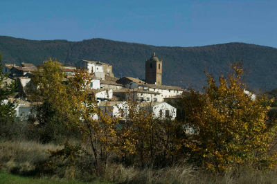
UNDUÉS DE LERDA
Undués de Lerda is the last municipality of Aragón through which the pilgrimage route to Santiago de Compostela passes, and is a UNESCO World Heritage Site. This pilgrimage path has its origin in the middle ages.
Already in the Middle Ages, many pilgrims went to Santiago, making the journey to earn forgiveness for their sins and find redemption. But it not only had religious relevance. In the time of the Reconquest, it was used for political purposes. The Christian advance was settling and consolidating around these pilgrimage cities while establishing cohesive ties between the populations and trying to create a unified identity. Later it became one of the most important trade routes and cultural exchanges of the Christian world.
Do not miss its great medieval snow store that served to keep snow and ice from melting for much longer, at a time when there were no refrigerators or electricity.
LOCATION
THE TREASURE OF UNDUÉS DE LERDA
LOCATION
THE TREASURE OF UNDUÉS DE LERDA
COORDINATES
You will find the treasure at the following coordinates: 42°33’36.3″N 1°10’09.8″W
Hint: Here there was ice and snow all year round.
Placed by: Clandestine Pre-Pyrenees
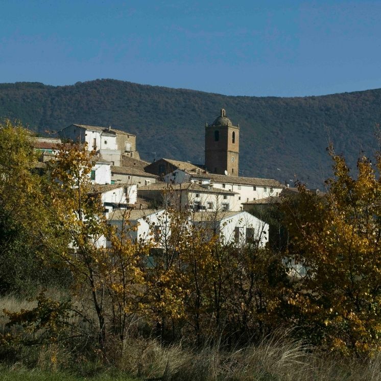
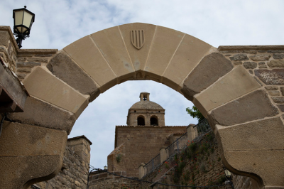
NAVARDÚN
This is border country. Over the centuries it has belonged to either Aragón or Navarre, according to the political and economic interests of the time. The fruits of this relationship between the two kingdoms, their history and that of their inhabitants can be seen in the cultural Interpretation Centre: “Aragón and Navarre, border kingdoms”.
The Interpretation Centre is in the most emblematic building in the town – the imposing medieval tower. Its construction dates back to between 1243 and 1304, although documentary sources indicate the existence of a castle in Navardún as early as 1198. The restored remains of the 25-meter tower are among the tallest in Aragon, which was originally part of a massive fortification.
LOCATION
HOURS
THE Navardún TREASURE
LOCATION
HOURS
“Aragón and Navarre, border kingdoms”.
The Torreón de Navardún is only open at weekends. But you can make a special appointment by phoning: +34 689-919438.
THE Navardún TREASURE
COORDINATES
You will find the treasure at the following coordinates:
42°30’46.6″N 1°08’44.5″W
Hint: Where the people of Navardún take the first communion
Placed by: Clandestine Pre-Pyrenees.
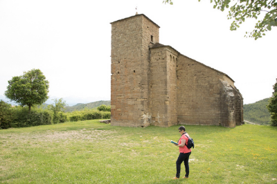
BAGÜÉS: CHURCH OF SAINTS JULIAN AND BASILISA
This small town is worth a visit because here we find the Church of Saints Julián and Basilisa, where once were found the most important Romanesque mural paintings in the world. These paintings were transferred to the Diocesan Museum of Jaca, although there are still some fragments on the walls of the church.
This XI century Lombard Romanesque construction had some paintings so richly embellished that it is believed that the construction of this church was financed by the monastery of San Juan de la Peña. The creation of these temples was part of the Cluny reform promoted by King Sancho Ramírez, son of Ramiro I.
LOCATION
THE BAGÜÉS TREASURE
LOCATION
THE BAGÜÉS TREASURE
COORDINATES
You will find the treasure at the following coordinates: 42°32’49.9″N 0°56’44.4″W
Hint: Get down
Author: Clandestine Pre-Pyrenees
LOS PINTANOS
The history of Los Pintanos is intimately related to Ramiro I. When he fled from the army of the Navarrese after trying to take Tafalla, he took refuge in this fortress. After that, it took the title of Castillo Real, and the town created a link with the king who would identify it as part of the Kingdom of Aragon for posterity. This loyalty cost them dearly when in 1283 Navarre and the French destroyed the valley, razing much of Pintano.
If you want to know more about the history of the area, and specifically the reign of Ramiro I and his relationship with the people, you should go to the Interpretation Center of the Route of the Castles. Through models, audiovisuals and archaeological remains you will learn all its history.
And if you are interested in even earlier history, do not forget to visit the Pintano Archaeological Centre. There you will discover information about the first settlers of these lands.
LOCATION
HOURS
THE PINTANO TREASURE
LOCATION
HOURS
Interpretation Centre of the Route of the Castles
If you want to visit, you can get the key from the Prepirineo de Undués Hostal. (42.2810073, -1.1006931) and then go to the Interpretation Centre on your own.
Pintano Archaeological Centre (Huella Paseo por la prehistoria)
You may make an appointment by phoning: +34 948-439038
THE PINTANO TREASURE
COORDINATES
You will find the treasure at the following coordinates: 42°32’12.6 “N 1 ° 02’36.5″W
Hint: Find an old place to wash
Author: Clandestine Pre-Pyrenees
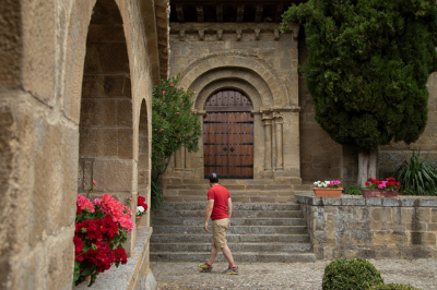
Urriés
This charming medieval enclave dates from 921 AD. Its medieval alleys still preserve their original structure. It also has the honour of having the narrowest street in the world.
Do not miss the Church of San Esteban, a Romanesque temple from the 12th century. It is a beautiful temple which once housed beautiful paintings that today are in the Diocesan Museum of Jaca. But do not worry, in the Interpretation Center of the Romanesque Paintings of Urriés you can learn about their history and see reproductions.
LOCATION
HOURS
THE URRIÉS TREASURE
LOCATION
HOURS
Interpretation Center of the Romanesque Paintings of Urriés
To visit it you should make an appointment phoning: +34 679-333384
THE URRIÉS TREASURE
COORDINATES
You will find the treasure at the following coordinates:
42.5192706, -1.1311054
Hint: Get down
Author: Stardustgold